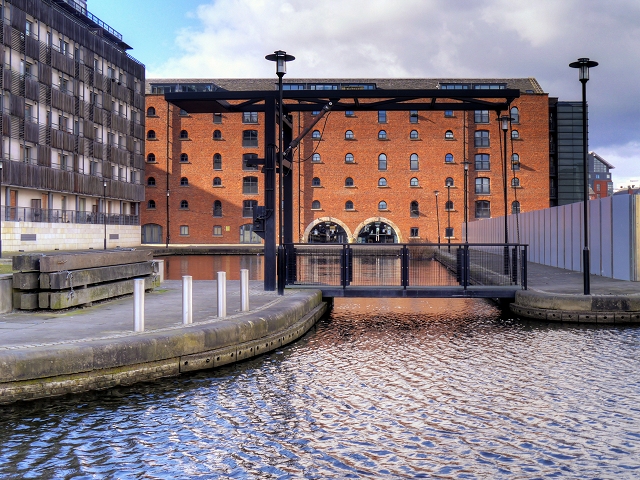
Vantage Quay and Jacksons Warehouse
Introduction
The photograph on this page of Vantage Quay and Jacksons Warehouse by David Dixon as part of the Geograph project.
The Geograph project started in 2005 with the aim of publishing, organising and preserving representative images for every square kilometre of Great Britain, Ireland and the Isle of Man.
There are currently over 7.5m images from over 14,400 individuals and you can help contribute to the project by visiting https://www.geograph.org.uk

Image: © David Dixon Taken: 24 Mar 2015
Originally called the Rochdale Canal Warehouse, Jackson's Warehouse (also known as Jacksons Warehouse) was built in 1836 on a small arm from the Rochdale Canal in central Manchester. A photograph at The Manchester Local Image Collection http://images.manchester.gov.uk/Display.php?session=pass&irn=14002 shows it still in use as a warehouse as late as 1961. Like other warehouses in central Manchester, it features 'shipping holes' at canal level on its main elevation. These allowed direct access into the building so that canal boats could unload under cover. Jackson’s Warehouse is a Grade II* listed building.( http://www.britishlistedbuildings.co.uk/en-457770-former-rochdale-canal-warehouse- British Listed Buildings). In 2003, it was converted into residential accommodation and a restaurant (http://www.engineering-timelines.com/scripts/engineeringItem.asp?id=1102 Engineering Timelines).

