Bench Mark, Enniskillen
Introduction
The photograph on this page of Bench Mark, Enniskillen by Rossographer as part of the Geograph project.
The Geograph project started in 2005 with the aim of publishing, organising and preserving representative images for every square kilometre of Great Britain, Ireland and the Isle of Man.

There are currently over 7.5m images from over 14,400 individuals and you can help contribute to the project by visiting https://www.geograph.org.uk
Bench Mark, Enniskillen
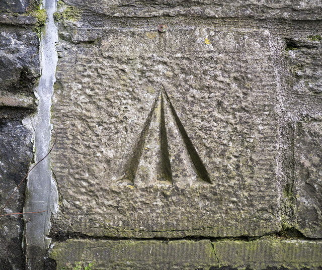
Image: © Rossographer Taken: 14 Mar 2015
Cut bench mark located on the west side of Enniskillen Castle. This mark dates from the 1st geodetic levelling of Ireland which took place in 1839-43. The mark was originally just a cut or pivot mark, but there is a small rivet added just above the arrow - if connected to the mark this would have been added later. The original remarks describe it as "Enniskillen Castle Barracks. Mark on sill of door; 3.3 ft. above surface." It was initially levelled to 165.237 feet above sea level; the mark does not appear on any modern maps.
Images are licensed for reuse under creativecommons.org/licenses/by-sa/2.0
Image Location
Latitude
54.34644
Longitude
-7.644615