Russell Fish Smoking and Processing Factory on Riby Street, Grimsby
Introduction
The photograph on this page of Russell Fish Smoking and Processing Factory on Riby Street, Grimsby by Chris as part of the Geograph project.
The Geograph project started in 2005 with the aim of publishing, organising and preserving representative images for every square kilometre of Great Britain, Ireland and the Isle of Man.

There are currently over 7.5m images from over 14,400 individuals and you can help contribute to the project by visiting https://www.geograph.org.uk
Russell Fish Smoking and Processing Factory on Riby Street, Grimsby
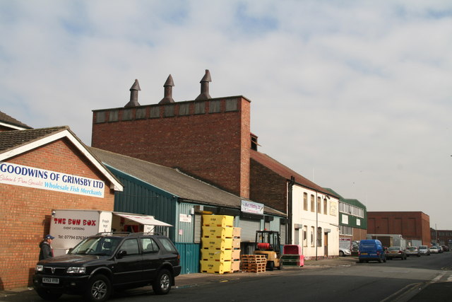
Image: © Chris Taken: 20 Mar 2015
The building with the chimneys. One of a number of fish smokeries, both trading and disused, in the dock area. Russell's, along with several others, is a listed building. See: http://list.historicengland.org.uk/resultsingle.aspx?uid=1379908. Russell's is included as the best and least altered example in Riby Street, and was built in the late C19-early C20, when Grimsby was one of the foremost fishing centres in the world. It forms an interesting comparison with the listed smoking-houses within the docks in the square bounded by Surtees Street, Brown Street and Sidebottom Street.
Images are licensed for reuse under creativecommons.org/licenses/by-sa/2.0
Image Location
Latitude
53.575301
Longitude
-0.067869