New dual carriageway and flyover, Greenisland (March 2015)
Introduction
The photograph on this page of New dual carriageway and flyover, Greenisland (March 2015) by Albert Bridge as part of the Geograph project.
The Geograph project started in 2005 with the aim of publishing, organising and preserving representative images for every square kilometre of Great Britain, Ireland and the Isle of Man.

There are currently over 7.5m images from over 14,400 individuals and you can help contribute to the project by visiting https://www.geograph.org.uk
New dual carriageway and flyover, Greenisland (March 2015)
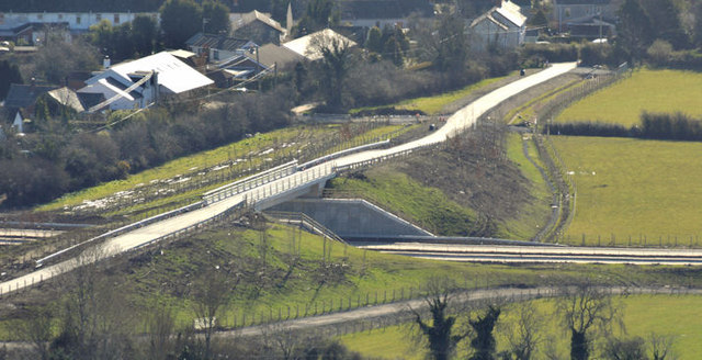
Image: © Albert Bridge Taken: 21 Mar 2015
The off-line section of the new Jordanstown – Greenisland dual carriageway. This part seems to be ready to use but won’t be open to traffic until the connection to the existing dual carriageway, on the Trooperslane side, is complete. The flyover carries Whinfield Lane. The view is from Knockagh Monument.
Images are licensed for reuse under creativecommons.org/licenses/by-sa/2.0
Image Location
Latitude
54.69963
Longitude
-5.855984