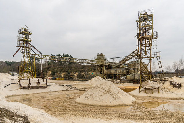
Sand processing plant
Introduction
The photograph on this page of Sand processing plant by Ian Capper as part of the Geograph project.
The Geograph project started in 2005 with the aim of publishing, organising and preserving representative images for every square kilometre of Great Britain, Ireland and the Isle of Man.
There are currently over 7.5m images from over 14,400 individuals and you can help contribute to the project by visiting https://www.geograph.org.uk

Image: © Ian Capper Taken: 14 Mar 2015
Part of the sand processing plant at Park Pit. Park Pit ceased to operate as a sand quarry in 1990 but processing of sand from nearby Tapwood Pit continued until 2014. Plans are being considered for conversion of Park Pit for leisure use. Regardless of the outcome, the processing plant is due to be removed by the last operators of the site, Hanson, during the first part of 2015. There is currently no public access to the site, this photo being taken on a private tour arranged for the Betchworth & Buckland Society.

