Former Lockwood Methodist Church
Introduction
The photograph on this page of Former Lockwood Methodist Church by Humphrey Bolton as part of the Geograph project.
The Geograph project started in 2005 with the aim of publishing, organising and preserving representative images for every square kilometre of Great Britain, Ireland and the Isle of Man.

There are currently over 7.5m images from over 14,400 individuals and you can help contribute to the project by visiting https://www.geograph.org.uk
Former Lockwood Methodist Church
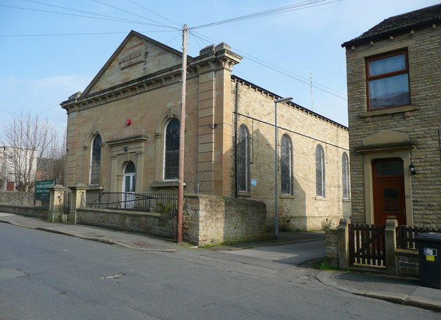
Image: © Humphrey Bolton Taken: 18 Mar 2015
Dated 1864; listed Grade II. Now an Islamic centre, and captioned 'mosque' on the large-scale map, but still marked with a cross on smaller scale maps. However, if a new 'crescent moon' symbol were introduced there would be problems with synagogues, Sikh and Hindu and Buddhist temples, etc!
Images are licensed for reuse under creativecommons.org/licenses/by-sa/2.0
Image Location
Latitude
53.632525
Longitude
-1.797928