The Huddersfield to Sheffield Railway
Introduction
The photograph on this page of The Huddersfield to Sheffield Railway by Humphrey Bolton as part of the Geograph project.
The Geograph project started in 2005 with the aim of publishing, organising and preserving representative images for every square kilometre of Great Britain, Ireland and the Isle of Man.

There are currently over 7.5m images from over 14,400 individuals and you can help contribute to the project by visiting https://www.geograph.org.uk
The Huddersfield to Sheffield Railway
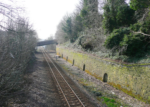
Image: © Humphrey Bolton Taken: 18 Mar 2015
Looking southwards from the footbridge off the top of Burbeary Road. The retaining wall has puzzling arched recesses that I have also seen elsewhere. I have been informed that they are "refuges for people at work on the railway in areas of limited clearance. When a train approaches you duck in there until it passes." A track is shown close to the wall on the 1906 1:2500 map. This was the approach to the junction with the Meltham branch line and the normal two tracks were supplemented by slanting 'slip' tracks.
Images are licensed for reuse under creativecommons.org/licenses/by-sa/2.0
Image Location
Latitude
53.631361
Longitude
-1.800807