Duston - St Luke's - West End
Introduction
The photograph on this page of Duston - St Luke's - West End by Rob Farrow as part of the Geograph project.
The Geograph project started in 2005 with the aim of publishing, organising and preserving representative images for every square kilometre of Great Britain, Ireland and the Isle of Man.

There are currently over 7.5m images from over 14,400 individuals and you can help contribute to the project by visiting https://www.geograph.org.uk
Duston - St Luke's - West End
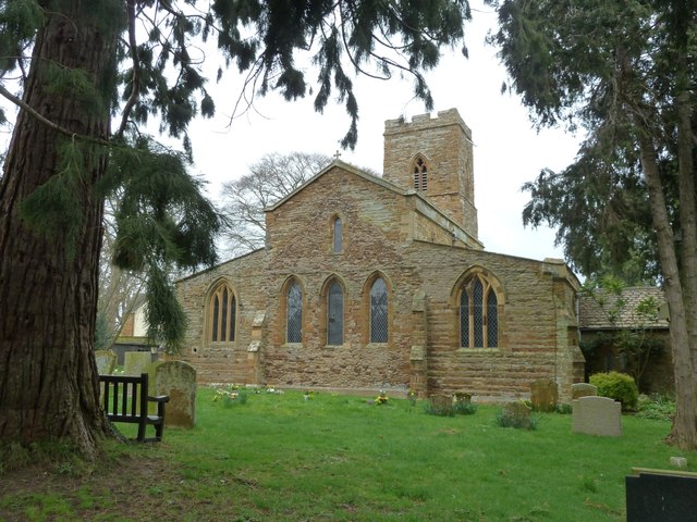
Image: © Rob Farrow Taken: 15 Mar 2015
A view of the wide west end of St Luke's church in Duston. This EH Grade I listed http://list.historicengland.org.uk/resultsingle.aspx?uid=1039755&searchtype=mapsearch church dates originally from the late C12th with substantial additions of the next two centuries. It contains a font considered to be one of the "Aylesbury Fonts" despite being (along with Eydon) somewhat geographically remote from the others. Unfortunately when I visited, the church was locked with no indication as to where a key might be obtained, so I was unable to get inside to photograph the font. For a side view of this church see Image] See also the shared description below:
Images are licensed for reuse under creativecommons.org/licenses/by-sa/2.0
Image Location
Latitude
52.242783
Longitude
-0.939902