Bench mark on Old Vicarage wall
Introduction
The photograph on this page of Bench mark on Old Vicarage wall by Shantavira as part of the Geograph project.
The Geograph project started in 2005 with the aim of publishing, organising and preserving representative images for every square kilometre of Great Britain, Ireland and the Isle of Man.

There are currently over 7.5m images from over 14,400 individuals and you can help contribute to the project by visiting https://www.geograph.org.uk
Bench mark on Old Vicarage wall
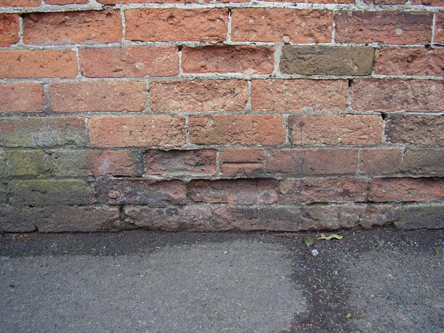
Image: © Shantavira Taken: 14 Mar 2015
This bench mark was established in 1851 during the First primary levelling of England & Wales, and was levelled with a height of 265.8810 feet [81.0405 metres] above mean sea level (Liverpool datum). It was included on the Sheffield to Birmingham (Branch Levelling to Darley Church) levelling line. The surveyor's description was "No. 6. Mark on brick wall in front of the Reverend Mr. Griffith's house ; 0.92 ft. above surface" (p364). The 1881-2 map shows this mark on the west face of the wall, east side of road, 5m south of the entrance. It is not shown on subsequent maps. The arrow is lost to a spalled brick, but the datum line is clear.
Images are licensed for reuse under creativecommons.org/licenses/by-sa/2.0
Image Location
Latitude
52.947427
Longitude
-1.479969