Burnt furze, Tom's Down
Introduction
The photograph on this page of Burnt furze, Tom's Down by Jim Champion as part of the Geograph project.
The Geograph project started in 2005 with the aim of publishing, organising and preserving representative images for every square kilometre of Great Britain, Ireland and the Isle of Man.

There are currently over 7.5m images from over 14,400 individuals and you can help contribute to the project by visiting https://www.geograph.org.uk
Burnt furze, Tom's Down
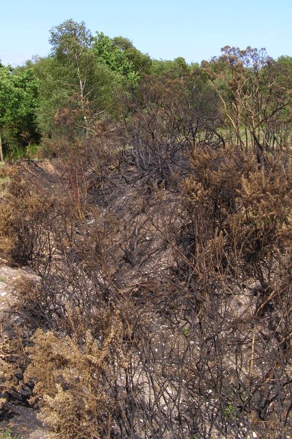
Image: © Jim Champion Taken: 19 May 2007
The gorse, or 'furze', growing in this ditch has been burnt - either accidentally or by an arsonist, as I don't think that such a small area would be burned as part of heathland management. To the south-east of this ditch there is a very dense and well-developed furze brake. This common is part of the Cadland Estate, and is grazed by ponies, but it is not part of the Crown lands of the New Forest. Gorse is usually burned on the Crown lands to stop it from getting too old (when it becomes very difficult for the commoners' stock to browse on).
Images are licensed for reuse under creativecommons.org/licenses/by-sa/2.0
Image Location
Latitude
50.815616
Longitude
-1.360763