Drumlin farmland at Aughlisnafin TD
Introduction
The photograph on this page of Drumlin farmland at Aughlisnafin TD by Eric Jones as part of the Geograph project.
The Geograph project started in 2005 with the aim of publishing, organising and preserving representative images for every square kilometre of Great Britain, Ireland and the Isle of Man.

There are currently over 7.5m images from over 14,400 individuals and you can help contribute to the project by visiting https://www.geograph.org.uk
Drumlin farmland at Aughlisnafin TD
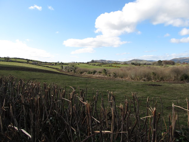
Image: © Eric Jones Taken: 10 Mar 2015
The Slieve Croob range can be seen in the background. The rocks of this range are over 400 million years old. The drumlins made of ice-smoothed glacially bourne debris are only some 13,000 years old. A wooded wetland can be seen in the middle ground.
Images are licensed for reuse under creativecommons.org/licenses/by-sa/2.0
Image Location
Latitude
54.281003
Longitude
-5.891611