Pater Hall, Pembroke Dock
Introduction
The photograph on this page of Pater Hall, Pembroke Dock by Jaggery as part of the Geograph project.
The Geograph project started in 2005 with the aim of publishing, organising and preserving representative images for every square kilometre of Great Britain, Ireland and the Isle of Man.

There are currently over 7.5m images from over 14,400 individuals and you can help contribute to the project by visiting https://www.geograph.org.uk
Pater Hall, Pembroke Dock
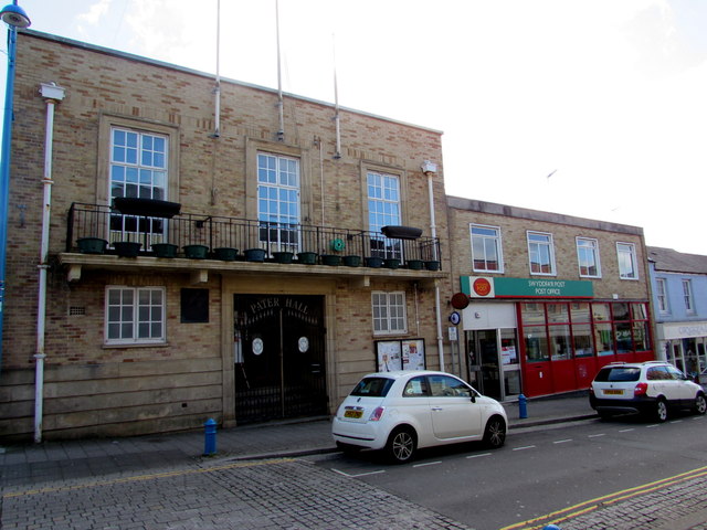
Image: © Jaggery Taken: 13 Mar 2015
On the corner of Dimond Street and Lewis Street, next door to Pembroke Dock Post Office. http://www.geograph.org.uk/photo/4383740 The hall was built on the site of the 19th century Temperance Hall which was destroyed by enemy aerial bombing in the Second World War.
Images are licensed for reuse under creativecommons.org/licenses/by-sa/2.0
Image Location
Latitude
51.693559
Longitude
-4.941353