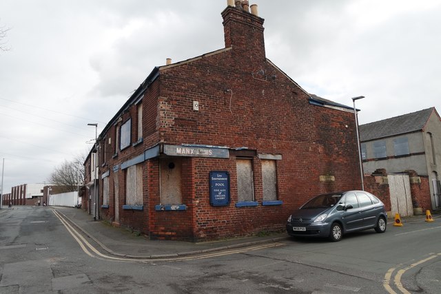
The Manx Arms, School Brow, Warrington - derelict pub
Introduction
The photograph on this page of The Manx Arms, School Brow, Warrington - derelict pub by Matt Harrop as part of the Geograph project.
The Geograph project started in 2005 with the aim of publishing, organising and preserving representative images for every square kilometre of Great Britain, Ireland and the Isle of Man.
There are currently over 7.5m images from over 14,400 individuals and you can help contribute to the project by visiting https://www.geograph.org.uk

Image: © Matt Harrop Taken: 5 Mar 2015
Few parts of nineteenth century Warrington were as industrialised as School Brow, Cockhedge and Howley but as well as factories, mills and tanneries, there were houses too: rows upon rows of cheap dilapidated working class dwellings that were home to thousands of men and women living as virtual slaves to their jobs. The School Brow of today is a very different place. Gone are the manufacturing industries and most of the old terraced housing. The Manx Arms closed its doors around 2013 and is now perilously derelict.

