Chester Terrace and Arch
Introduction
The photograph on this page of Chester Terrace and Arch by David Anstiss as part of the Geograph project.
The Geograph project started in 2005 with the aim of publishing, organising and preserving representative images for every square kilometre of Great Britain, Ireland and the Isle of Man.

There are currently over 7.5m images from over 14,400 individuals and you can help contribute to the project by visiting https://www.geograph.org.uk
Chester Terrace and Arch
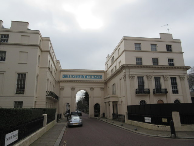
Image: © David Anstiss Taken: 8 Mar 2015
This large arch leads to a terrace of palace-style 37 houses. All Grade I listed. See http://www.britishlistedbuildings.co.uk/en-476897-numbers-1-42-and-attached-railings-and-l for more details.
Images are licensed for reuse under creativecommons.org/licenses/by-sa/2.0
Image Location
Latitude
51.530163
Longitude
-0.145591