
Arkley: Arkley Windmill
Introduction
The photograph on this page of Arkley: Arkley Windmill by Nigel Cox as part of the Geograph project.
The Geograph project started in 2005 with the aim of publishing, organising and preserving representative images for every square kilometre of Great Britain, Ireland and the Isle of Man.

There are currently over 7.5m images from over 14,400 individuals and you can help contribute to the project by visiting https://www.geograph.org.uk
Arkley: Arkley Windmill
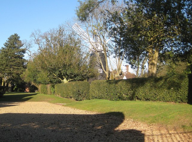
Image: © Nigel Cox Taken: 7 Mar 2015
This old corn mill probably dates from around 1830, falling into disuse around 1916. It is a circular brick tower mill with a cap, a fantail and four common sails. It has been restored at various times, once after it suffered gale damage in 1974. It is a Grade II* Listed Building. The windmill is not easy to see from publicly accessible areas. This is the view from Brickfield Lane.
Images are licensed for reuse under creativecommons.org/licenses/by-sa/2.0
Image Location

Latitude
51.643066
Longitude
-0.242304