New Bridge, Rocky Lane
Introduction
The photograph on this page of New Bridge, Rocky Lane by Simon Carey as part of the Geograph project.
The Geograph project started in 2005 with the aim of publishing, organising and preserving representative images for every square kilometre of Great Britain, Ireland and the Isle of Man.

There are currently over 7.5m images from over 14,400 individuals and you can help contribute to the project by visiting https://www.geograph.org.uk
New Bridge, Rocky Lane
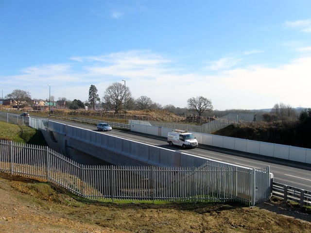
Image: © Simon Carey Taken: 7 Mar 2015
Built to replace Image with the bridge put in place in early 2014 and opened to the public from August 2014 onwards, more than a year ahead schedule. Beyond is another new development called The Beeches which the council allowed only if Crest Nicholson, the developers, built the new bridge and this section of the A272 relief road. It also means the boundary of Haywards Heath which for many years ran along Rocky Lane is now creeping southwards.
Images are licensed for reuse under creativecommons.org/licenses/by-sa/2.0
Image Location
Latitude
50.984764
Longitude
-0.112982