Old shelter in Brent Park
Introduction
The photograph on this page of Old shelter in Brent Park by Marathon as part of the Geograph project.
The Geograph project started in 2005 with the aim of publishing, organising and preserving representative images for every square kilometre of Great Britain, Ireland and the Isle of Man.

There are currently over 7.5m images from over 14,400 individuals and you can help contribute to the project by visiting https://www.geograph.org.uk
Old shelter in Brent Park
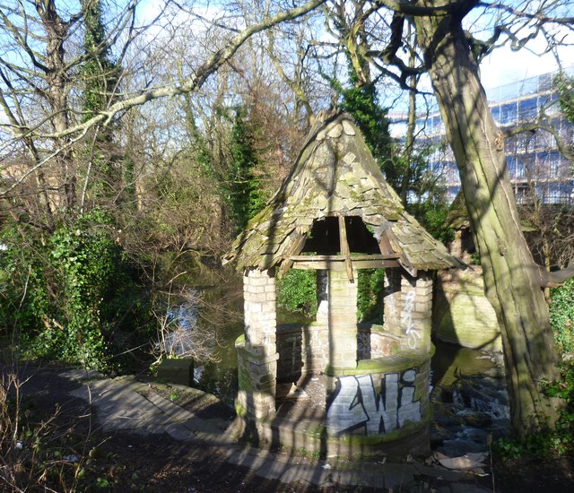
Image: © Marathon Taken: 4 Mar 2015
The Dollis Brook joins with the Mutton Brook near to the North Circular Road and just upriver of here to form the River Brent. Its route is followed by a thin strip of woodland along the riverbank and ribbon of open land on either side, providing a valuable green corridor. It is known as Brent Park. This shelter is just before the River Brent passes under Brent Street, from where this photograph is taken. Sadly it has seen better days. The Capital Ring follows the River Brent here.
Images are licensed for reuse under creativecommons.org/licenses/by-sa/2.0
Image Location
Latitude
51.581651
Longitude
-0.212633