Ramsbottom
Introduction
The photograph on this page of Ramsbottom by David Dixon as part of the Geograph project.
The Geograph project started in 2005 with the aim of publishing, organising and preserving representative images for every square kilometre of Great Britain, Ireland and the Isle of Man.

There are currently over 7.5m images from over 14,400 individuals and you can help contribute to the project by visiting https://www.geograph.org.uk
Ramsbottom
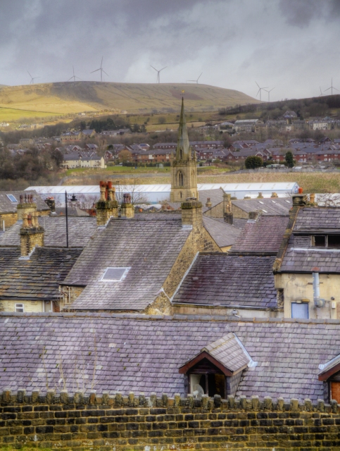
Image: © David Dixon Taken: 2 Mar 2015
A view looking over the village/town of Ramsbottom from Callender Street. The most prominent feature is the tower and spire of Image] in the centre of the village. The turbines of the Scout Moor Wind Farm (Image]) dominate the skyline on the hill on the opposite side of the valley.
Images are licensed for reuse under creativecommons.org/licenses/by-sa/2.0
Image Location
Latitude
53.648537
Longitude
-2.319316