Path to 'Windy Nook', Whitehills
Introduction
The photograph on this page of Path to 'Windy Nook', Whitehills by Anthony Foster as part of the Geograph project.
The Geograph project started in 2005 with the aim of publishing, organising and preserving representative images for every square kilometre of Great Britain, Ireland and the Isle of Man.

There are currently over 7.5m images from over 14,400 individuals and you can help contribute to the project by visiting https://www.geograph.org.uk
Path to 'Windy Nook', Whitehills
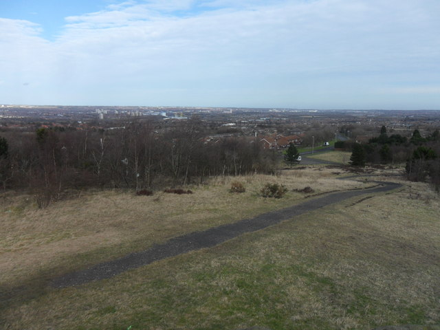
Image: © Anthony Foster Taken: 25 Feb 2015
Richard Cole's Windy Nook, completed in 1986 transformed a former colliery slag heap and is noted for its excellent views. At the summit is a terrace of concentric semi-circular stone walls and turfed earthworks incorporating 2,500 tons of granite recycled from pillars supporting the old Scotswood Bridge.
Images are licensed for reuse under creativecommons.org/licenses/by-sa/2.0
Image Location
Latitude
54.935701
Longitude
-1.567022