Ivy Cottage
Introduction
The photograph on this page of Ivy Cottage by Robin Webster as part of the Geograph project.
The Geograph project started in 2005 with the aim of publishing, organising and preserving representative images for every square kilometre of Great Britain, Ireland and the Isle of Man.

There are currently over 7.5m images from over 14,400 individuals and you can help contribute to the project by visiting https://www.geograph.org.uk
Ivy Cottage
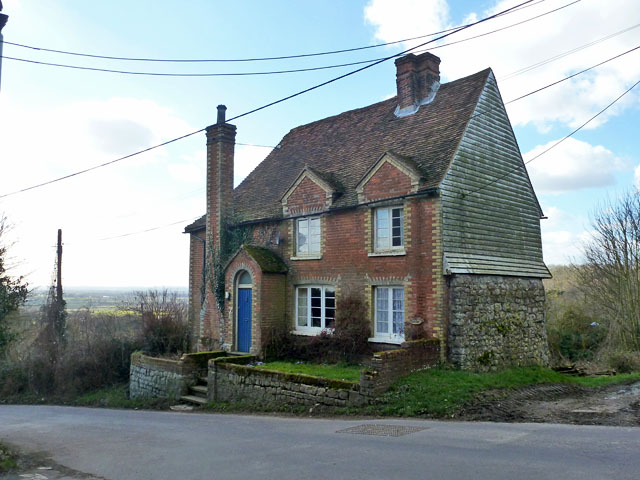
Image: © Robin Webster Taken: 27 Feb 2015
A grade II listed 16th century or earlier timber framed house with 19th century alterations, mainly the brick facade it would appear.
Images are licensed for reuse under creativecommons.org/licenses/by-sa/2.0
Image Location


Leaflet Map data © OpenStreetMap
Latitude
51.216374
Longitude
0.569647