Crossing Thinhope Burn at Burnstones
Introduction
The photograph on this page of Crossing Thinhope Burn at Burnstones by Andrew Curtis as part of the Geograph project.
The Geograph project started in 2005 with the aim of publishing, organising and preserving representative images for every square kilometre of Great Britain, Ireland and the Isle of Man.

There are currently over 7.5m images from over 14,400 individuals and you can help contribute to the project by visiting https://www.geograph.org.uk
Crossing Thinhope Burn at Burnstones
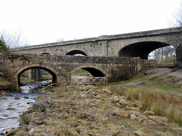
Image: © Andrew Curtis Taken: 18 Feb 2015
The road bridge is in the foreground with the railway viaduct behind. The viaduct was built with six arches, five of which had semi-circular skew spans of 30 feet (one blind) while the sixth, over the A689 road, had an elliptical span of 39 feet, skewed in the opposite direction. Although officially known on the Alston Branch Railway as Thinhope Burn Viaduct, it was known locally as Burnstones Bridge from the nearby hamlet and farm. The asymmetric design of the 37 foot high viaduct Image was said to have been suggested by a passing gypsy or tramp just as the railway constructors were due to start work, although this seems unlikely. The railway bridge was opened in 1852. Beyond the railway viaduct, a much older route also crossed the burn here, probably via a ford, that of the Maiden Way Roman road, now partly followed by the Pennine Way National Trail.
Images are licensed for reuse under creativecommons.org/licenses/by-sa/2.0
Image Location
Latitude
54.882751
Longitude
-2.507478