Mostly buried bridge by Downs Link trail
Introduction
The photograph on this page of Mostly buried bridge by Downs Link trail by Robin Webster as part of the Geograph project.
The Geograph project started in 2005 with the aim of publishing, organising and preserving representative images for every square kilometre of Great Britain, Ireland and the Isle of Man.

There are currently over 7.5m images from over 14,400 individuals and you can help contribute to the project by visiting https://www.geograph.org.uk
Mostly buried bridge by Downs Link trail
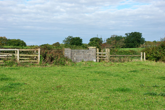
Image: © Robin Webster Taken: 22 Oct 2010
The Downs Link trail normally uses the trackbed of the old railway, but here a cutting has been filled in. The trail follows a roughly parallel course to one side of where the cutting was. Showing here is the north end of a bridge parapet which extends to the left, mainly obscured by vegetation.
Images are licensed for reuse under creativecommons.org/licenses/by-sa/2.0
Image Location
Latitude
51.026475
Longitude
-0.355853