Signs of the old station, Southwater
Introduction
The photograph on this page of Signs of the old station, Southwater by Robin Webster as part of the Geograph project.
The Geograph project started in 2005 with the aim of publishing, organising and preserving representative images for every square kilometre of Great Britain, Ireland and the Isle of Man.

There are currently over 7.5m images from over 14,400 individuals and you can help contribute to the project by visiting https://www.geograph.org.uk
Signs of the old station, Southwater
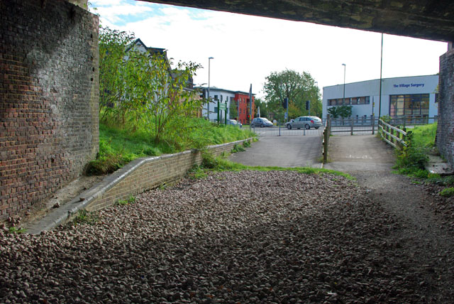
Image: © Robin Webster Taken: 22 Oct 2010
The platform end is still there, partially buried, under the bridge. The road over the bridge is now diverted to the route seen ahead, and the course of the railway is used by the Downs Link trail.
Images are licensed for reuse under creativecommons.org/licenses/by-sa/2.0
Image Location
Latitude
51.024445
Longitude
-0.352217