Hoyland Lowe
Introduction
The photograph on this page of Hoyland Lowe by Rude Health as part of the Geograph project.
The Geograph project started in 2005 with the aim of publishing, organising and preserving representative images for every square kilometre of Great Britain, Ireland and the Isle of Man.

There are currently over 7.5m images from over 14,400 individuals and you can help contribute to the project by visiting https://www.geograph.org.uk
Hoyland Lowe
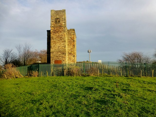
Image: © Rude Health Taken: 23 Nov 2014
Highest accessible point on path next to folly but reservoir obviously higher, maybe also rough ground behind folly. Name: Hoyland Lowe Hill number: 16767 Height: 183m / 600ft Parent (Ma/M): 2810 Black Hill Section: 36: Lancashire, Cheshire & the Southern Pennines County/UA: Barnsley (UA) Class: Tump (100-199m) Grid ref: SE 36310 00971 Summit feature: no feature: ground on path by folly Drop: 35m Col: 148m SK353998
Images are licensed for reuse under creativecommons.org/licenses/by-sa/2.0
Image Location
Latitude
53.504174
Longitude
-1.453885