Railway bridge LTN1/187, Kelvedon
Introduction
The photograph on this page of Railway bridge LTN1/187, Kelvedon by Robin Webster as part of the Geograph project.
The Geograph project started in 2005 with the aim of publishing, organising and preserving representative images for every square kilometre of Great Britain, Ireland and the Isle of Man.

There are currently over 7.5m images from over 14,400 individuals and you can help contribute to the project by visiting https://www.geograph.org.uk
Railway bridge LTN1/187, Kelvedon
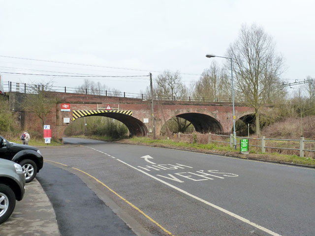
Image: © Robin Webster Taken: 15 Feb 2015
This bridge spans the River Blackwater with the middle span. The vehicle clearance in the middle of the road span is 14'-3". The right bank of the river is actually in Feering parish, and on it may just be seen the terminal end of the embankment for the station of the former Kelvedon and Tollesbury Light Railway. The only foot access to this station seems to have been a walkway over the bridge from the main line station off to the left.
Images are licensed for reuse under creativecommons.org/licenses/by-sa/2.0
Image Location
Latitude
51.841471
Longitude
0.70368