The Stonhouse, Clapham
Introduction
The photograph on this page of The Stonhouse, Clapham by Derek Harper as part of the Geograph project.
The Geograph project started in 2005 with the aim of publishing, organising and preserving representative images for every square kilometre of Great Britain, Ireland and the Isle of Man.

There are currently over 7.5m images from over 14,400 individuals and you can help contribute to the project by visiting https://www.geograph.org.uk
The Stonhouse, Clapham
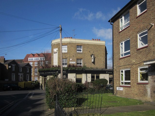
Image: © Derek Harper Taken: 8 Feb 2015
The pub is at the corner of Stonhouse Street and Cresset Street. The pair of semis in shadow on the left are listed http://list.english-heritage.org.uk/resultsingle.aspx?uid=1100354&searchtype=mapsearch . Between the two is a glimpse of Clapham Manor Primary School, dating from 1881.
Images are licensed for reuse under creativecommons.org/licenses/by-sa/2.0
Image Location
Latitude
51.463843
Longitude
-0.137051