Tolls foot crossing, Bough Beech
Introduction
The photograph on this page of Tolls foot crossing, Bough Beech by Robin Webster as part of the Geograph project.
The Geograph project started in 2005 with the aim of publishing, organising and preserving representative images for every square kilometre of Great Britain, Ireland and the Isle of Man.

There are currently over 7.5m images from over 14,400 individuals and you can help contribute to the project by visiting https://www.geograph.org.uk
Tolls foot crossing, Bough Beech
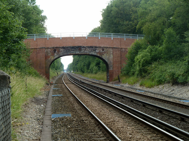
Image: © Robin Webster Taken: 3 Jul 2011
The view west prior to a user crossing south to north. This crossing was risk assessed in 2011 at individual risk D (scale A bad - M good) and collective risk 7 (scale 1 bad - 13 good). An assessment in 2014 changed the collective risk to 6. The stated line speed was 85 mph. There were 54 trains rising to 64 per day, 4 foot users per day. These assessments are questionable, as neither mention the very limited visibility west for a north - south crosser. See Image and Image
Images are licensed for reuse under creativecommons.org/licenses/by-sa/2.0
Image Location


Leaflet Map data © OpenStreetMap
Latitude
51.201609
Longitude
0.126906