Newcastle-under-Lyme: Unitarian Meeting House
Introduction
The photograph on this page of Newcastle-under-Lyme: Unitarian Meeting House by Jonathan Hutchins as part of the Geograph project.
The Geograph project started in 2005 with the aim of publishing, organising and preserving representative images for every square kilometre of Great Britain, Ireland and the Isle of Man.

There are currently over 7.5m images from over 14,400 individuals and you can help contribute to the project by visiting https://www.geograph.org.uk
Newcastle-under-Lyme: Unitarian Meeting House
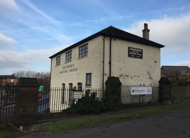
Image: © Jonathan Hutchins Taken: 7 Feb 2015
Viewed from the precincts of St Giles’ church. The sign on the wall facing the churchyard states: THE OLD MEETING HOUSE c1650 rebuilt 1717. The original building was in fact burned down by rioters in 1715.
Images are licensed for reuse under creativecommons.org/licenses/by-sa/2.0
Image Location


Leaflet Map data © OpenStreetMap
Latitude
53.011623
Longitude
-2.230381