The southern end of Heathgate
Introduction
The photograph on this page of The southern end of Heathgate by Marathon as part of the Geograph project.
The Geograph project started in 2005 with the aim of publishing, organising and preserving representative images for every square kilometre of Great Britain, Ireland and the Isle of Man.

There are currently over 7.5m images from over 14,400 individuals and you can help contribute to the project by visiting https://www.geograph.org.uk
The southern end of Heathgate
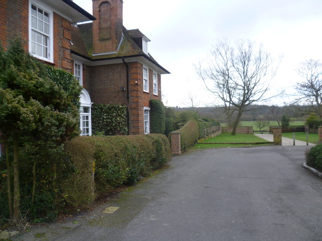
Image: © Marathon Taken: 4 Feb 2015
Hampstead Garden Suburb was founded in 1907 by Henrietta Barnett to be a model community where all classes of people could live together in attractive surroundings and social harmony. Heathgate is the formal avenue which links Central Square and its two churches with Hampstead Heath Extension. This is the view from the end of Heathgate where it crosses 'The Great Wall' to reach the Heath Extension. The idea of a distinctive boundary separating the residential Suburb and the rural Heath Extension was evident within the early plans for the Suburb. Its inspiration came from medieval German fortified towns where the country came up to the walls and the idea was turned into the reality of the Great Wall by Charles Paget Wade. The Garden Suburb Development Company began construction in 1910 but building was interrupted by the Great War and the wall extends only from Hampstead Way to Heathgate. Hampstead Heath Extension was not added to Hampstead Heath until 1907, at about the time that Hampstead Garden Suburb to the north was being created. The Heath Extension was created out of farmland, largely due to the efforts of Henrietta Barnett. Its farmland origins can still be seen in the form of old field boundaries, hedgerows and trees. There are a group of ponds near the eastern edge, close to Wildwood Road. See also http://www.geograph.org.uk/photo/4338725
Images are licensed for reuse under creativecommons.org/licenses/by-sa/2.0
Image Location
Latitude
51.577669
Longitude
-0.187532