Bedehouse, Newark, Notts.
Introduction
The photograph on this page of Bedehouse, Newark, Notts. by David Hallam-Jones as part of the Geograph project.
The Geograph project started in 2005 with the aim of publishing, organising and preserving representative images for every square kilometre of Great Britain, Ireland and the Isle of Man.

There are currently over 7.5m images from over 14,400 individuals and you can help contribute to the project by visiting https://www.geograph.org.uk
Bedehouse, Newark, Notts.
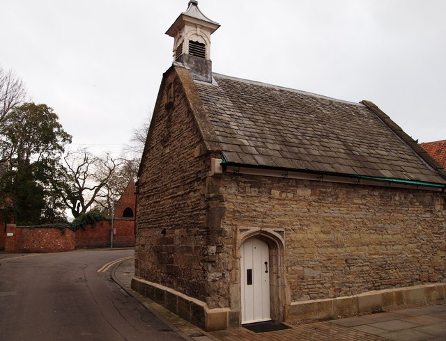
Image: © David Hallam-Jones Taken: 1 Feb 2015
A view from the Barnby Gate end of Bede House Lane. The Grade II-listed stone-built bedehouse (or almshouse complex) was founded on 18th March 1558, through the will of William Philpott, "for the continued ease, funding and lodging of five poor men." In the C19th the chamberlains (or treasurers) used a surplus of funds with which they enlarged the bedehouse to accommodate 15 individuals - five of whom were women. The buildings formed a quadrangle. One large building of two storeys occupied the East and South wings, while the North was enclosed by a wall and this former chapel. The chapel has been used in the recent past as a Volunteers' 'recruitment' centre but is currently standing unused. Newark College, a post-16 institution belonging to Lincoln College (in Lincolnshire), is situated beyond the wall ahead and round the corner.
Images are licensed for reuse under creativecommons.org/licenses/by-sa/2.0
Image Location
Latitude
53.075616
Longitude
-0.806116