No?s 38, 42 & 44, Bridgegate
Introduction
The photograph on this page of No?s 38, 42 & 44, Bridgegate by Mike Kirby as part of the Geograph project.
The Geograph project started in 2005 with the aim of publishing, organising and preserving representative images for every square kilometre of Great Britain, Ireland and the Isle of Man.

There are currently over 7.5m images from over 14,400 individuals and you can help contribute to the project by visiting https://www.geograph.org.uk
No?s 38, 42 & 44, Bridgegate
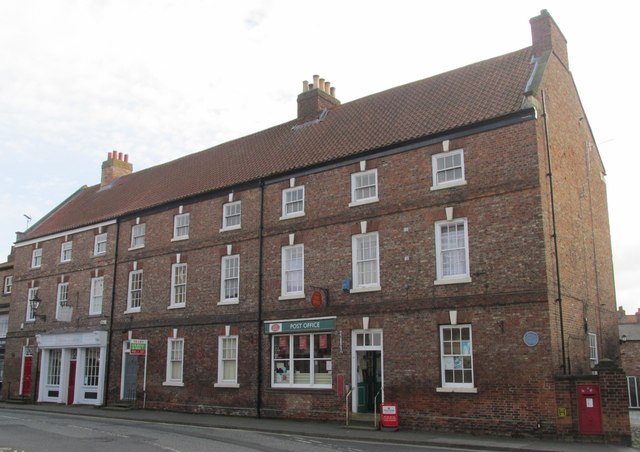
Image: © Mike Kirby Taken: 22 Oct 2014
A grade II listed terrace of 3 houses and shops, comprising of 3 storeys and 9 first-floor windows. Dated mid C18 with C20 restoration. Constructed in brick, partly in Flemish bond, partly in English bond with a replacement pantile roof. LBS No:- 165322
Images are licensed for reuse under creativecommons.org/licenses/by-sa/2.0
Image Location


Leaflet Map data © OpenStreetMap
Latitude
53.746423
Longitude
-0.865735