Aspatria's station building, now privately owned
Introduction
The photograph on this page of Aspatria's station building, now privately owned by Christine Johnstone as part of the Geograph project.
The Geograph project started in 2005 with the aim of publishing, organising and preserving representative images for every square kilometre of Great Britain, Ireland and the Isle of Man.

There are currently over 7.5m images from over 14,400 individuals and you can help contribute to the project by visiting https://www.geograph.org.uk
Aspatria's station building, now privately owned
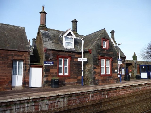
Image: © Christine Johnstone Taken: 2 Feb 2015
Each gable end has a stone face below the chimney. Between the two storeys of the bay is the remains of a painted sign 'ASPATRIA STATION'. Originally part of the Maryport and Carlisle Railway, the line from Maryport to Aspatria opened in 1841.
Images are licensed for reuse under creativecommons.org/licenses/by-sa/2.0
Image Location


Leaflet Map data © OpenStreetMap
Latitude
54.75886
Longitude
-3.332337