Site of Crystal Palace (High Level) Branch
Introduction
The photograph on this page of Site of Crystal Palace (High Level) Branch by Robin Webster as part of the Geograph project.
The Geograph project started in 2005 with the aim of publishing, organising and preserving representative images for every square kilometre of Great Britain, Ireland and the Isle of Man.

There are currently over 7.5m images from over 14,400 individuals and you can help contribute to the project by visiting https://www.geograph.org.uk
Site of Crystal Palace (High Level) Branch
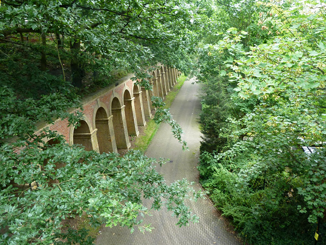
Image: © Robin Webster Taken: 23 Jul 2011
A view from above the mouth of Paxton Tunnel of the site of the approaches to the terminal station. The retaining wall on the left extends all the way from the tunnel to the site of the station, where its design changes. The area is now a housing estate, the houses hidden by the trees on the right.
Images are licensed for reuse under creativecommons.org/licenses/by-sa/2.0
Image Location
Latitude
51.42366
Longitude
-0.076691