Devon Bridge, Newark Marina Vicinity, Notts.
Introduction
The photograph on this page of Devon Bridge, Newark Marina Vicinity, Notts. by David Hallam-Jones as part of the Geograph project.
The Geograph project started in 2005 with the aim of publishing, organising and preserving representative images for every square kilometre of Great Britain, Ireland and the Isle of Man.

There are currently over 7.5m images from over 14,400 individuals and you can help contribute to the project by visiting https://www.geograph.org.uk
Devon Bridge, Newark Marina Vicinity, Notts.
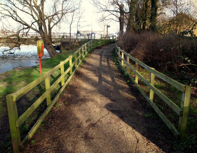
Image: © David Hallam-Jones Taken: 1 Feb 2015
The source of the River Devon seen passing under Devon Bridge (both being (pronounced "Deevon") is several springs near Eastwell in Leicestershire. However, at this point it is within 300-400 yards of its mouth, the River Trent. Once under Devon Bridge boat-users find themselves alongside some moorings opposite Newark Marina. Administratively the area on this side of the bridge is in the parish of Hawton, a small village of 700 inhabitants that played an important part in the English Civil War as the site of a Roundhead encampment that raged against the Royalist stronghold in Newark. The tower of All Saints, its Grade I-listed C14th and C15th Church, overlooks the Trent floodplain. This footpath links Farndon Road (the B6166), seen ahead, with Devon Park.
Images are licensed for reuse under creativecommons.org/licenses/by-sa/2.0
Image Location
Latitude
53.070215
Longitude
-0.823429