Tower block, Herne Hill Estate
Introduction
The photograph on this page of Tower block, Herne Hill Estate by Robin Webster as part of the Geograph project.
The Geograph project started in 2005 with the aim of publishing, organising and preserving representative images for every square kilometre of Great Britain, Ireland and the Isle of Man.

There are currently over 7.5m images from over 14,400 individuals and you can help contribute to the project by visiting https://www.geograph.org.uk
Tower block, Herne Hill Estate
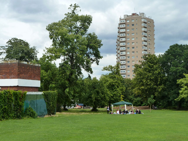
Image: © Robin Webster Taken: 23 Jul 2011
Viewed from such an angle in Brockwell Park that one of the two identical blocks here is almost completely hidden by the other. They are pentagonal in plan, not an easy shape for fitting out.
Images are licensed for reuse under creativecommons.org/licenses/by-sa/2.0
Image Location
Latitude
51.453434
Longitude
-0.104803