Trinity Congregational Church
Introduction
The photograph on this page of Trinity Congregational Church by Robin Webster as part of the Geograph project.
The Geograph project started in 2005 with the aim of publishing, organising and preserving representative images for every square kilometre of Great Britain, Ireland and the Isle of Man.

There are currently over 7.5m images from over 14,400 individuals and you can help contribute to the project by visiting https://www.geograph.org.uk
Trinity Congregational Church
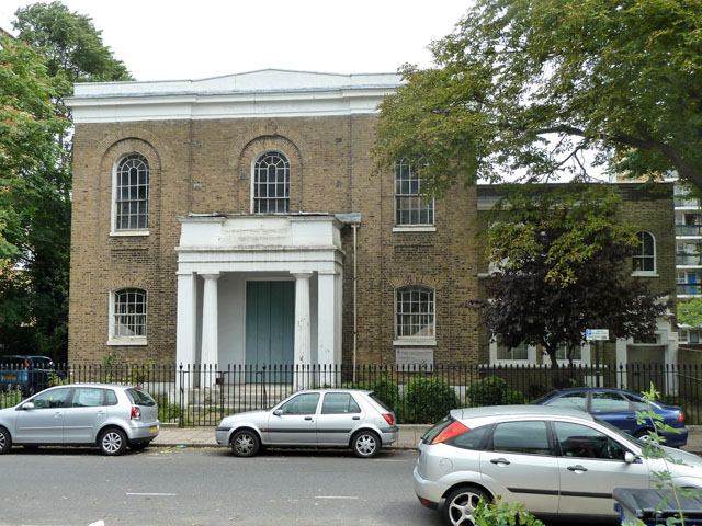
Image: © Robin Webster Taken: 23 Jul 2011
A grade II listed building of 1828, built as 'Trinity Chapel', as displayed in the frieze*. There are unfortunate cracks extending upwards from the two visible upper windows, possibly the third as well, suggesting the building could do with a lateral tie or two. *Not 'Trinity Church' as the listed building citation states.
Images are licensed for reuse under creativecommons.org/licenses/by-sa/2.0
Image Location
Latitude
51.457661
Longitude
-0.115999