Cwmdare Mission, Cwmdare
Introduction
The photograph on this page of Cwmdare Mission, Cwmdare by Jaggery as part of the Geograph project.
The Geograph project started in 2005 with the aim of publishing, organising and preserving representative images for every square kilometre of Great Britain, Ireland and the Isle of Man.

There are currently over 7.5m images from over 14,400 individuals and you can help contribute to the project by visiting https://www.geograph.org.uk
Cwmdare Mission, Cwmdare
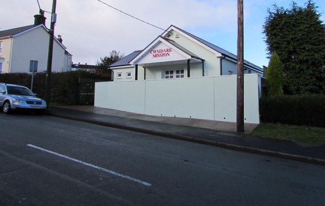
Image: © Jaggery Taken: 31 Jan 2015
Viewed across Cwmdare Road. In the early years of the 20th century, there were several chapels in the village, in which services were in Welsh. Cwmdare Mission was established in 1911 in the Boys School to give Cwmdare an English-speaking place of worship. The Mission has been on this site since 1921. At the end of January 2015, the building looks recently renovated.
Images are licensed for reuse under creativecommons.org/licenses/by-sa/2.0
Image Location
Latitude
51.721059
Longitude
-3.473822