Somerset Coal Canal entrance
Introduction
The photograph on this page of Somerset Coal Canal entrance by John Winder as part of the Geograph project.
The Geograph project started in 2005 with the aim of publishing, organising and preserving representative images for every square kilometre of Great Britain, Ireland and the Isle of Man.

There are currently over 7.5m images from over 14,400 individuals and you can help contribute to the project by visiting https://www.geograph.org.uk
Somerset Coal Canal entrance
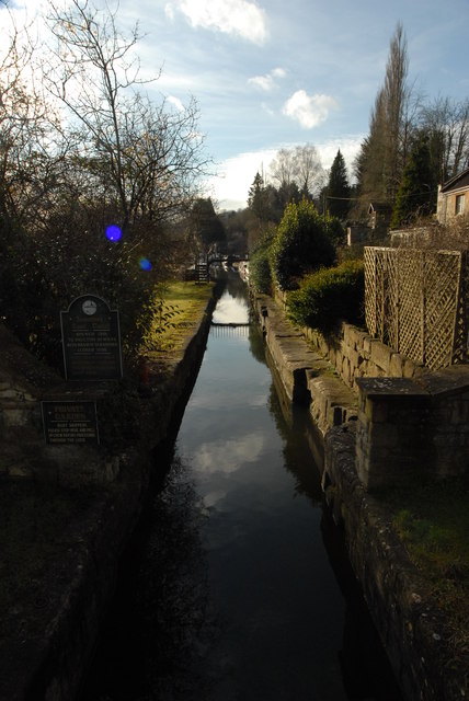
Image: © John Winder Taken: 27 Jan 2015
The Somerset Coal Canal was built around 1800 to link the Somerset coalfield with London, via the Kennet & Avon Canal. With the exception of the branch to Radstock, which closed in 1815 (being replaced by a tramway which was later incorporated into the well known Somerset & Dorset Railway), the canal was a commercial success for nearly a century, only declining in importance as the coalfields became exhausted in the late 1800s. In the late 1890s the canal fell quickly into disuse and was officially closed in 1902, various parts of the route being bought by railway companies and converted to railways. This shot shows the entrance to the restored first half mile or so of the canal near Dundas Aqueduct. There is a scheme to restore the entire canal to navigation, but for the moment, this leads to a dead end basin which is used as moorings.
Images are licensed for reuse under creativecommons.org/licenses/by-sa/2.0
Image Location
Latitude
51.361151
Longitude
-2.312049