Main Street/Tippings Lane Junction, Farnsfield, Notts.
Introduction
The photograph on this page of Main Street/Tippings Lane Junction, Farnsfield, Notts. by David Hallam-Jones as part of the Geograph project.
The Geograph project started in 2005 with the aim of publishing, organising and preserving representative images for every square kilometre of Great Britain, Ireland and the Isle of Man.

There are currently over 7.5m images from over 14,400 individuals and you can help contribute to the project by visiting https://www.geograph.org.uk
Main Street/Tippings Lane Junction, Farnsfield, Notts.
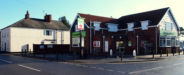
Image: © David Hallam-Jones Taken: 30 Jan 2015
The only supermarket in the village also provides a home to the Post Office. The New Inn public house stood on this site for most of the C19th, owned by the Tipping family. It was demolished in 1960 and a new pub, The Warwick Arms was built to replace it. This closed and the Co-operative Society opened a store in it, c.2008/9. Main Street continues towards Erdingley beyond the large white-painted house.
Images are licensed for reuse under creativecommons.org/licenses/by-sa/2.0
Image Location
Latitude
53.102226
Longitude
-1.034056