Hailgate House, No.41, Hailgate
Introduction
The photograph on this page of Hailgate House, No.41, Hailgate by Mike Kirby as part of the Geograph project.
The Geograph project started in 2005 with the aim of publishing, organising and preserving representative images for every square kilometre of Great Britain, Ireland and the Isle of Man.

There are currently over 7.5m images from over 14,400 individuals and you can help contribute to the project by visiting https://www.geograph.org.uk
Hailgate House, No.41, Hailgate
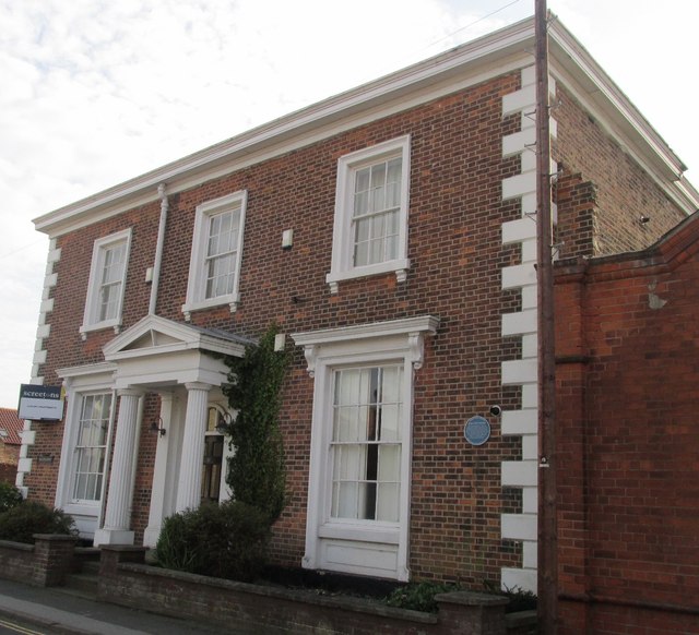
Image: © Mike Kirby Taken: 22 Oct 2014
A grade II listed house, dated c1840. Constructed in red brick with ashlar dressings and quoins, a central-hallway entry with a Greek Doric pedimented porch and a Welsh slate roof. Described in the listing text as the Boothferry Borough Council Planning Department, the house has now been converted into private apartments. See Image LBS No:- 165340
Images are licensed for reuse under creativecommons.org/licenses/by-sa/2.0
Image Location
Latitude
53.746407
Longitude
-0.864067