Wykeham Street Bridge
Introduction
The photograph on this page of Wykeham Street Bridge by Alan Walker as part of the Geograph project.
The Geograph project started in 2005 with the aim of publishing, organising and preserving representative images for every square kilometre of Great Britain, Ireland and the Isle of Man.

There are currently over 7.5m images from over 14,400 individuals and you can help contribute to the project by visiting https://www.geograph.org.uk
Wykeham Street Bridge
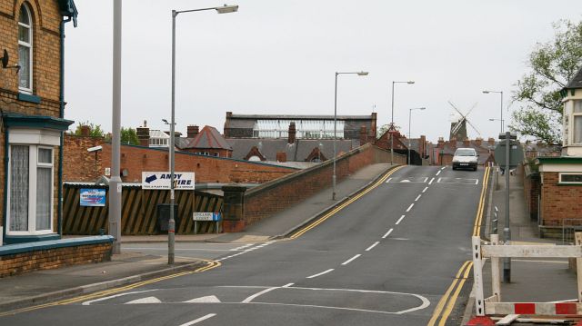
Image: © Alan Walker Taken: 2 May 2007
Some 20metres ahead (easterly) of the viewpoint Wykeham Street has a junction with Image (right, southerly) and Image (left, northerly). Beyond these junctions is Wykeham Street Bridge, which once crossed a goods yard and the Scarborough to Whitby railway. The railway was closed by government as a result of the report, “The Reshaping of British Railways” issued on 27th March 1963 by Dr Richard Beeching, Chairman of the British Railways Board. On the old track bed to the left (north side) of the bridge is a Image and to the right is a superstore. On the other side of the bridge are Image and then Wykeham Street’s junctions with Gladstone Road and Roscoe Street. The building with the large, glass roof is the junior school hall. After being derelict for decades, the windmill in the distance was visually restored and the building was turned into a restaurant as part of the Old Mill Hotel on Mill Street. See also this photograph by Glyn Baker, Image For a photograph of Wykeham Street from approximately the same viewpoint but looking in the opposite (westerly) direction, click here Image
Images are licensed for reuse under creativecommons.org/licenses/by-sa/2.0
Image Location


Leaflet Map data © OpenStreetMap
Latitude
54.279371
Longitude
-0.414782