'Oak House', Aysgarth School
Introduction
The photograph on this page of 'Oak House', Aysgarth School by Roger Templeman as part of the Geograph project.
The Geograph project started in 2005 with the aim of publishing, organising and preserving representative images for every square kilometre of Great Britain, Ireland and the Isle of Man.

There are currently over 7.5m images from over 14,400 individuals and you can help contribute to the project by visiting https://www.geograph.org.uk
'Oak House', Aysgarth School
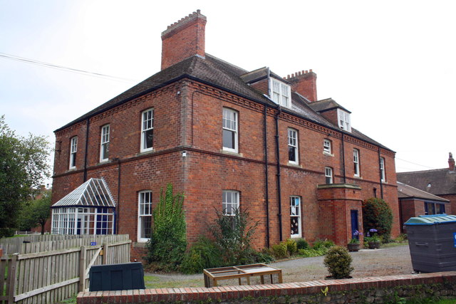
Image: © Roger Templeman Taken: 21 Sep 2014
This building was referred to as 'Clifton Cottage' in 1955 by the Ordnance Survey when it verified the benchmark Image cut into the bricks on the near corner, right hand face. However, the building is now called 'Oak House'. It was built as the masters accommodation for the School in 1890 when the School was built on this site. It has subsequently been converted to its current use as a Nursery and Pre Prep School.
Images are licensed for reuse under creativecommons.org/licenses/by-sa/2.0
Image Location
Latitude
54.296561
Longitude
-1.683301