Progress blocked on Kirkby Stephen - Warcop road, 1991
Introduction
The photograph on this page of Progress blocked on Kirkby Stephen - Warcop road, 1991 by Ben Brooksbank as part of the Geograph project.
The Geograph project started in 2005 with the aim of publishing, organising and preserving representative images for every square kilometre of Great Britain, Ireland and the Isle of Man.

There are currently over 7.5m images from over 14,400 individuals and you can help contribute to the project by visiting https://www.geograph.org.uk
Progress blocked on Kirkby Stephen - Warcop road, 1991
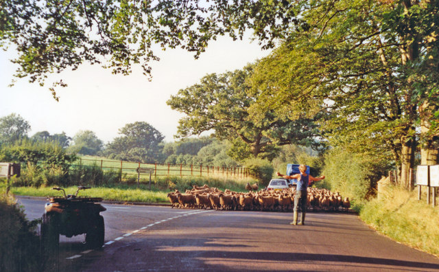
Image: © Ben Brooksbank Taken: 31 Aug 1991
View northward on the B6259, encountering large flock of sheep at the turning for Soulby - a typical rural encounter: note the fellow's scooter on the left. (Until closed 22/1/62, the Kirkby Stephen - Penrith branch of the ex-NER line over Stainmore would have been running parallel on the left).
Images are licensed for reuse under creativecommons.org/licenses/by-sa/2.0
Image Location


Leaflet Map data © OpenStreetMap
Latitude
54.510231
Longitude
-2.363381