Ruins of Rolle Canal building
Introduction
The photograph on this page of Ruins of Rolle Canal building by David Smith as part of the Geograph project.
The Geograph project started in 2005 with the aim of publishing, organising and preserving representative images for every square kilometre of Great Britain, Ireland and the Isle of Man.

There are currently over 7.5m images from over 14,400 individuals and you can help contribute to the project by visiting https://www.geograph.org.uk
Ruins of Rolle Canal building
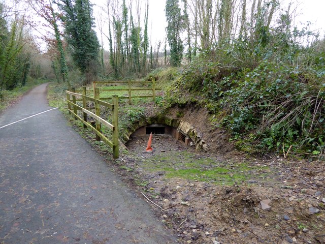
Image: © David Smith Taken: 23 Jan 2015
The white line on the surface of the Tarka Trail (former railway line) marks the extent of the winding house for the boats, whose vault is on the right of the trail
Images are licensed for reuse under creativecommons.org/licenses/by-sa/2.0
Image Location


Leaflet Map data © OpenStreetMap
Latitude
50.98053
Longitude
-4.190768