Shireoaks Village Hall
Introduction
The photograph on this page of Shireoaks Village Hall by Alan Murray-Rust as part of the Geograph project.
The Geograph project started in 2005 with the aim of publishing, organising and preserving representative images for every square kilometre of Great Britain, Ireland and the Isle of Man.

There are currently over 7.5m images from over 14,400 individuals and you can help contribute to the project by visiting https://www.geograph.org.uk
Shireoaks Village Hall
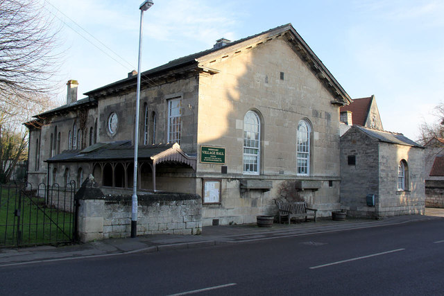
Image: © Alan Murray-Rust Taken: 20 Jan 2015
Built in 1810 as a chapel of ease by John Hewitt of Shireoaks Hall, and converted to a school when St Luke's Church was built in the 1860s. Listed Grade II.
Images are licensed for reuse under creativecommons.org/licenses/by-sa/2.0
Image Location
Latitude
53.322048
Longitude
-1.170371