Former public house at Shireoaks
Introduction
The photograph on this page of Former public house at Shireoaks by Alan Murray-Rust as part of the Geograph project.
The Geograph project started in 2005 with the aim of publishing, organising and preserving representative images for every square kilometre of Great Britain, Ireland and the Isle of Man.

There are currently over 7.5m images from over 14,400 individuals and you can help contribute to the project by visiting https://www.geograph.org.uk
Former public house at Shireoaks
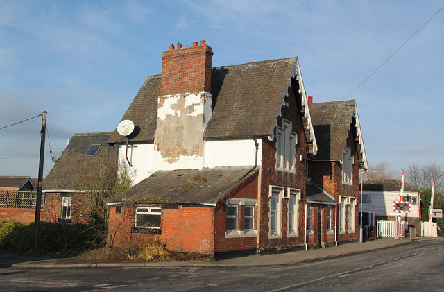
Image: © Alan Murray-Rust Taken: 20 Jan 2015
No indication on old maps of what the name might have been, but it's right next to the station, so. . . The local history society website records it as having been built at the same time as the railway, and it could well have been at the instigation of the Duke of Newcastle, as with most of the other local buildings of the same era.
Images are licensed for reuse under creativecommons.org/licenses/by-sa/2.0
Image Location
Latitude
53.324548
Longitude
-1.16792