
Kidbrooke Village: Cator Park
Introduction
The photograph on this page of Kidbrooke Village: Cator Park by Stephen Craven as part of the Geograph project.
The Geograph project started in 2005 with the aim of publishing, organising and preserving representative images for every square kilometre of Great Britain, Ireland and the Isle of Man.

There are currently over 7.5m images from over 14,400 individuals and you can help contribute to the project by visiting https://www.geograph.org.uk
Kidbrooke Village: Cator Park
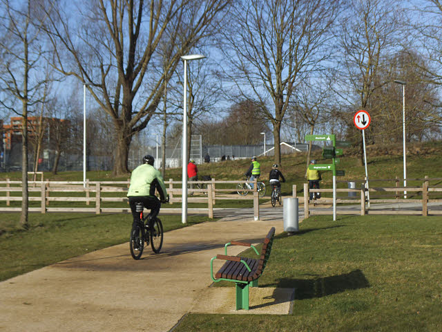
Image: © Stephen Craven Taken: 24 Jan 2015
This path runs through Cator Park, a linear park in the redeveloped Kidbrooke estate, and the cyclists shown here are crossing Cambert Way (one of the few roads of the old estate still to exist on its original alignment). It is difficult to compare old photos with new in this estate with great precision, as the whole area is being completely transformed, but for the buildings previously around Cambert Way see Image nearly six years earlier, and Image shows their demolition in 2012.
Images are licensed for reuse under creativecommons.org/licenses/by-sa/2.0
Image Location

Latitude
51.458139
Longitude
0.027825