Kidbrooke Village: new phase starting
Introduction
The photograph on this page of Kidbrooke Village: new phase starting by Stephen Craven as part of the Geograph project.
The Geograph project started in 2005 with the aim of publishing, organising and preserving representative images for every square kilometre of Great Britain, Ireland and the Isle of Man.

There are currently over 7.5m images from over 14,400 individuals and you can help contribute to the project by visiting https://www.geograph.org.uk
Kidbrooke Village: new phase starting
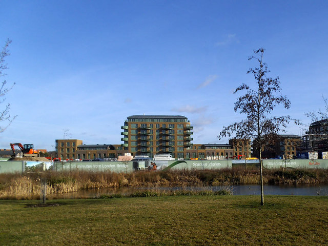
Image: © Stephen Craven Taken: 24 Jan 2015
In the distance is one large housing block already completed on the west side of Tudway Road; between that and the pond further construction work was still at demolition stage. It is difficult to compare old photos with new in this estate with great precision, as the whole area is being completely transformed, but this is roughly the area between Cambert Way and Romero Square in the former Kidbrooke Estate. See Image for a view in nearly the same location barely five years earlier.
Images are licensed for reuse under creativecommons.org/licenses/by-sa/2.0
Image Location
Latitude
51.458277
Longitude
0.030278