St John?s Road
Introduction
The photograph on this page of St John?s Road by Alan Walker as part of the Geograph project.
The Geograph project started in 2005 with the aim of publishing, organising and preserving representative images for every square kilometre of Great Britain, Ireland and the Isle of Man.

There are currently over 7.5m images from over 14,400 individuals and you can help contribute to the project by visiting https://www.geograph.org.uk
St John?s Road
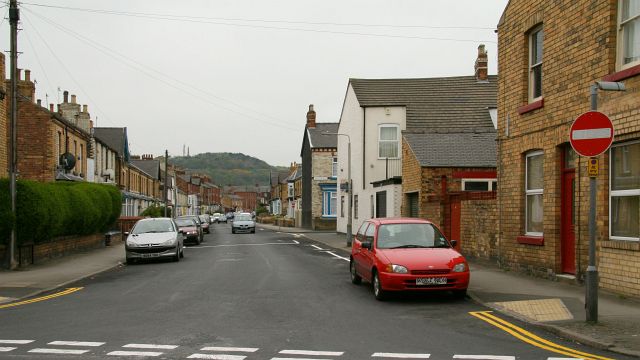
Image: © Alan Walker Taken: 2 May 2007
The photograph, which was taken from its junction with Image (immediate foreground), is looking south south-easterly along St John’s Road toward Falsgrave. The hill in the distance is called Oliver’s Mount http://www.geograph.org.uk/photo/2239258 . The two structures on the hill are a communications transmitter (left) and the town's war memorial (right). In the 1950’s (and well into the 80’s) the white building (ahead, on the corner of St John’s Road and Image) used to be it to be the archetypical British corner shop. In addition the building on the near right was a corner shop as was the one on the left (out of shot). For a more south south-easterly (ahead) photograph of St John’s Road, click here Image Road name information from OS Maps at:- Elgin, http://www.elgin.gov.uk/
Images are licensed for reuse under creativecommons.org/licenses/by-sa/2.0
Image Location
Latitude
54.278662
Longitude
-0.415577