Barn at Manor Farm
Introduction
The photograph on this page of Barn at Manor Farm by Alan Murray-Rust as part of the Geograph project.
The Geograph project started in 2005 with the aim of publishing, organising and preserving representative images for every square kilometre of Great Britain, Ireland and the Isle of Man.

There are currently over 7.5m images from over 14,400 individuals and you can help contribute to the project by visiting https://www.geograph.org.uk
Barn at Manor Farm
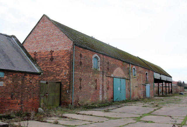
Image: © Alan Murray-Rust Taken: 20 Jan 2015
The north face of the barn which forms the north range of the original farmyard. The main doorway clearly originally mirrored the Tudor arched smaller openings. Listed Grade II. See also http://www.geograph.org.uk/photo/4320225
Images are licensed for reuse under creativecommons.org/licenses/by-sa/2.0
Image Location
Latitude
53.391458
Longitude
-1.110076